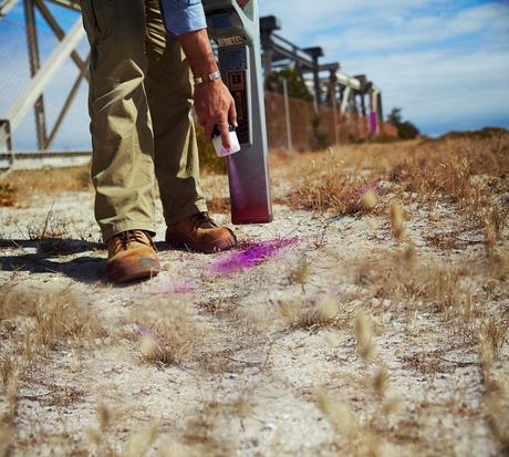
Subsurface location

Subsurface utility and object location is a complex process that requires safe and reliable equipment to provide accurate and useful information.
Subsurface utility and object location is a complex process that requires safe and reliable equipment to provide accurate and useful information. Industry experts rely on a variety of tools, technology and software to scan a surface quickly and efficiently. Gathered data is then interpreted to determine exactly what kind of objects lie underground and where they are positioned.
The precision and reliability of the subsurface scanning results are extremely important to construction site managers and workers who are planning to dig or drill into the surface. This information about the site’s underground is used to avoid hitting objects or utilities, to protect equipment and surface structures, to guarantee worksite safety and to ensure compliance with state occupational safety and health regulations.
Avoid large fines
Coming into contact or causing damage to services or utilities will more than likely cause an interruption in essential services, create a dangerous working environment and potentially result in serious injury. The aim of occupational safety and health regulations is obviously to prevent this from occurring, so failure to comply with these laws before and during any construction processes could lead to large financial penalties.
For instance, in Western Australia penalties for an individual are $10,000 for a first offence and $12,500 for any subsequent transgression. In the case of a body corporate, these figures double to $20,000 in the first instance with any additional offences attracting a penalty of $25,000. These are hefty fines, but they can be easily avoided by taking the right precautions and ensuring that each and every utility situated in the work area is located and mapped.
Subsurface imaging professionals tend to use two types of non-destructive underground service location equipment: ground penetrating radar (GPR) and electromagnetic line locators.
GPR
Ground penetrating radar utilises high-frequency pulses to detect objects located under the ground. Radio waves are released into the ground and deflect back to the scanning equipment once they bounce off an object under the surface.
The changes in the waves emitted and the waves received are then interpreted by the equipment software to determine the type of material it has found, as well as its size and location. The results are usually displayed on an LCD panel to review in real time and can be saved for further interpretation and for use in compliance with government regulations. GPR equipment is generally used to locate items such as pipes, tanks, manholes and cables which cannot be detected by other types of subsurface location technology.
The major advantage of using GPR is its information reliability and accuracy when scanning and identifying various materials such as soil, ice, rock, concrete and pavement. GPR technology provides all the information needed to create an accurate diagrammatic representation of the site’s underground utilities.
While GPR is a very effective and reliable tool, it does have some limitations as its effectiveness can be influenced by the ground conditions. Soils like clay and saline have a high electrical conductivity, which can restrict the GPR from accurately penetrating the soil. Another limitation is that high-frequency antennas can only reach short distances underground.
Electromagnetic line locators
An electromagnetic line locator is a very common subsurface scanning method and is frequently used to locate utilities. This tool does not locate the pipes and cables themselves, but rather detects any electromagnetic fields as they transition along the object. This electromagnetic field is then interpreted by the equipment’s receiver.
Electromagnetic line locators are essential tools as they function well in a wide range of ground conditions and are generally fast and reliable to use. The major limitation to this technology is that it can only locate metallic pipes and lines, or objects that have been marked with metallic trace wires. Any objects like optic fibre, PVC, asbestos and non-ductile pipes will not be ‘seen’ by electromagnetic utility locators.
Overcoming scanning limitations
Although both types of equipment can provide accurate and valuable data about the subsurface area of a site, it is clear that their respective limitations can also result in some objects not being detected in the scanning process, which can result in incomplete scanning and subsurface data.
To overcome this obstacle, GPR and electromagnetic line locators are often used in conjunction with each other, allowing technicians to cross-reference the scanning results and ensure much better accuracy and a more comprehensive picture of the subsurface area.
All-electric haulage fleet under mining alliance
A strategic alliance between Newmont and Caterpillar will see the rapid deployment of an...
How to measure ROI of field service management software
Some ROIs are easier to calculate than others. It's important to consider both tangible and...
Preparing the grid for electric vehicles
A new $3.4 million trial will help support growing adoption of electric vehicles across Australia...


